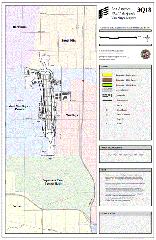
Noise Contour Maps
The following Airport Impact Area maps show the noise contours for VNY and the affected land uses. These contours are established by modeling annual operations at the airport and adjusting the levels based on actual noise measurement data for that time period. Each 4th Quarter map is based on calendar year information for the respective year. The contours shown are measured in CNEL (Community Noise Equivalent Level) for the 65dB and 70dB noise levels. These maps will be updated quarterly during the current year as they become available.
(The maps on this page are best viewed in the 1024 x 768 screen resolution.)
Note: Links below require Adobe Acrobat Reader to view